
WebODM
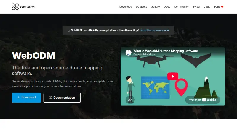
WebODM creates georeferenced maps and other 3D and terrain products from aerial imagery.
What WebODM is
WebODM creates georeferenced maps and other 3D and terrain products from aerial imagery. It accepts photos and videos from any drone, including JPG, TIFF, video files, and multispectral imagery, and runs on a user’s computer even without an internet connection. Outputs include GeoTIFF, PNG, LAS/LAZ, OBJ, and OGC 3D Tiles. Mapping tools cover measurements, plant-health indexes, ground-control points, elevation contours, rolling-shutter correction, and sharing links. WebODM uses ODX, a free, open-source photogrammetry engine, and can connect to processing nodes that use the NodeODX API. The software is free to install and use locally; cloud plans are also listed, including Starter at $24 a month billed yearly, Pro at $35 a month billed yearly, and Business at $99 a month billed yearly. Minimum requirements are 8 GB RAM and 20 GB disk space, with more recommended for larger datasets.
Good
- Runs locally, including when offline.
- Accepts imagery from any drone.
- Exports GeoTIFF, LAS/LAZ, OBJ, and other formats.
- Includes measurements and ground-control points.
- Free to install and use.
Watch out
- Minimum requirements include 8 GB RAM and 20 GB disk space.
- Larger datasets have higher recommended hardware requirements.
- Cloud plans have map, image, task, or storage limits.
Who it suits
WebODM suits drone users who need to turn aerial imagery into maps, point clouds, elevation models, or textured 3D outputs. Its offline operation and export formats may also fit users working with local processing or GIS data.
Verdict
WebODM combines local, offline photogrammetry with a broad set of mapping outputs and tools. Check the listed hardware requirements and cloud-plan limits against your datasets and workflow.
Plans and prices
From WebODM's own pricing page, checked 15 Oct 2026.
| Plan | Price | What it gives you |
|---|---|---|
| WebODM | Free | 100% free to install and use · runs locally and offline |
| Starter | $24 a month | 12 maps per 30 days, then pay per map · up to 1,500 images per map · max 1 concurrent task · 25 GB cloud storage · Billed Yearly |
| Pro | $35 a month | unlimited maps · up to 1,500 images per map · max 2 concurrent tasks · 100 GB cloud storage · Billed Yearly |
| Business | $99 a month | unlimited maps · up to 3,000 images per map · max 4 concurrent tasks · 1,000 GB cloud storage · Billed Yearly |
| Pay As You Go | — | up to 1,500 images per map · max 30 concurrent tasks · temporary cloud storage · pay per map |
The facts
Each one read from WebODM's own pages, with the date it was checked.
What it does
- 3D models
- It produces textured OBJ models and OGC 3D Tiles.checked 15 Oct 2026
- Access control
- WebODM provides model-level and row-level permissions that control whether users can view, add, edit or delete objects.checked 30 Sep 2026
- Accuracy limitation
- An independent WebODM guide says results without GCPs or RTK/PPK depend on drone GPS, which can have errors of several metres.checked 15 Oct 2026
- AGPL obligation
- Hysen Labs explains that network users of modified WebODM versions must be offered the corresponding source code under AGPL-3.0.checked 15 Oct 2026
- API
- The public API is documented as OpenAPI 2.0 and uses basic authentication terminology with token-based examples.checked 15 Oct 2026
- API authentication
- Clients obtain a token from /api/token-auth/ and send it in an Authorization JWT header; tokens expire after six hours by default.checked 15 Oct 2026
- API coverage
- Documented endpoints cover projects, tasks, processing nodes, users, permissions, uploads, task control and result downloads.checked 15 Oct 2026
- Contour tools
- Elevation contours can be previewed and exported to AutoCAD, Shapefile and GeoPackage.checked 15 Oct 2026
- Dataset limit on minimum RAM
- With 8 GB RAM, the download page warns that processing more than about 100 images may not be possible.checked 15 Oct 2026
- Ecosystem
- The WebODM ecosystem includes NodeODX, CloudODX, PyODX, ClusterODX, OpenSplat, OATS and CameraLib.checked 30 Sep 2026
- Elevation models
- It creates digital surface and terrain elevation models.checked 15 Oct 2026
- Exports
- Listed exports include GeoTIFF, PNG, LAS/LAZ, OBJ and OGC 3D Tiles.checked 15 Oct 2026
- Gaussian splats
- The software can generate and display Gaussian splats for photorealistic rendering.checked 15 Oct 2026
- GPU acceleration
- CUDA GPU processing is available to speed up dataset processing.checked 15 Oct 2026
- Ground control points
- Ground control points can be created and used to improve positional accuracy.checked 15 Oct 2026
- Hardware limit
- The download page lists 20 GB free disk space and 8 GB RAM as minimum requirements, with 16 GB RAM and 100 GB disk space recommended for larger datasets.checked 30 Sep 2026
- Image inputs
- It accepts photos or videos from any drone and supports JPG, TIFF, video files and multispectral imagery.checked 30 Sep 2026
- Independent output evidence
- The University of Florida walkthrough reports orthophoto, surface-model, point-cloud, textured-model, camera-parameter, camera-shot and quality-report outputs.checked 15 Oct 2026
- Independent processing-node evidence
- The University of Florida walkthrough says separate processing nodes can distribute workloads and improve efficiency for large datasets.checked 15 Oct 2026
- Independent technical review
- Hysen Labs describes the project as AGPL-3.0 software deployed as a four-container self-hosted stack, mainly written in Python.checked 15 Oct 2026
The company
- Company founder
- UAV4GEO says Piero Toffanin founded the company in 2014 and created WebODM.checked 15 Oct 2026
- Company headquarters
- UAV4GEO states that it is located in St Petersburg, Florida, United States.checked 15 Oct 2026
- Company ownership context
- The official UAV4GEO page says the company is privately run without private-equity ownership.checked 15 Oct 2026
- Founded
- 2016checked 23 Sep 2026
The full review of WebODM
WebODM is photogrammetry software that turns drone imagery into georeferenced maps, elevation models and 3D outputs. It suits surveyors, mapping teams and technically minded users who want local processing or control over a cloud workflow. Its strongest case is the combination of offline use, extensive export formats and a free local plan; larger jobs still demand capable hardware or a paid cloud tier.
Overview
WebODM accepts photos and videos from any drone, including JPG, TIFF, video and multispectral imagery. Processing runs on the user’s computer and works offline, which makes it a practical fit when cloud access is undesirable or unavailable. The trade-off is that local work depends on your own machine: the minimum requirements are 8 GB RAM and 20 GB of free disk space, while larger datasets call for 16 GB RAM and 100 GB of storage.
The software is built around ODX, a free, open-source photogrammetry engine that can also be used from the command line or integrated into other software. Its broader ecosystem includes NodeODX, CloudODX, PyODX, ClusterODX, OpenSplat, OATS and CameraLib. For more category options, see Photogrammetry Software and AI 3D Scanning Software.
Key features
WebODM produces georeferenced maps, point clouds, digital elevation models, textured 3D models and Gaussian splats. Its measurement and mapping tools include ground-control points, plant-health indexes, elevation contours and rolling-shutter correction. Exports span high-resolution GeoTIFF and PNG, LAS/LAZ, OBJ and OGC 3D Tiles, giving users options for GIS, point-cloud and 3D workflows.
Sharing links make it possible to pass results to others. Processing can also connect to nodes that speak the NodeODX API, including NodeODX, NodeMICMAC, ClusterODX and WebODM Lightning. The API uses token authentication at /api/token-auth/, with tokens expiring after six hours by default. Model-level and row-level permissions let administrators control whether users can view, add, edit or delete objects; that granularity is useful for shared deployments, though it also suits users comfortable managing access rules.
Pricing
The WebODM plan costs nothing: it is free to install and use, runs locally and works offline. It is the natural starting point for individuals and teams willing to supply their own hardware and manage local processing.
Cloud plans are billed yearly, with monthly prices shown. Starter costs $24 a month and allows 12 maps per 30 days, then charges per map; it supports up to 1,500 images per map, one concurrent task and 25 GB of cloud storage. That cap suits occasional cloud users but can make frequent processing less predictable in cost. Pro costs $35 a month for unlimited maps, up to 1,500 images per map, two concurrent tasks and 100 GB of storage. It is a better fit for regular workloads that need more capacity than Starter, without a higher image ceiling.
Business costs $99 a month and adds a 3,000-image-per-map limit, up to four concurrent tasks and 1,000 GB of storage, alongside unlimited maps. Those higher limits suit teams processing larger jobs in parallel. Pay As You Go uses custom pricing: it charges per map, allows up to 1,500 images per map and 30 concurrent tasks, with temporary cloud storage. It may suit bursty processing that benefits from concurrency without a fixed map allowance, but temporary storage is less appropriate when results need to remain in the cloud. All three subscription prices are billed yearly.
Platforms
WebODM supports Linux, macOS and Windows, as well as web access, an API and self-hosted deployment. The choice of local and cloud deployment lets users prioritize offline control or managed processing. UAV4GEO says its cloud service uses SSL encryption, secured data centers behind firewalls, password or secure-key access and encrypted passwords.
Who it's for
WebODM is best for users turning drone captures into geospatial and 3D deliverables who value offline operation, open-source processing or a choice between self-hosting and cloud plans. Its broad inputs and exports make it relevant to mapping and GIS work, while ground-control points, measurements and plant-health indexes add practical analysis tools. Users with limited RAM or storage, or those who want a simple phone-first capture workflow, should weigh its hardware demands and desktop-oriented processing model carefully.
Pros and cons
- Pro: Local, offline processing is included at no cost, avoiding dependence on a cloud plan for users with suitable hardware.
- Pro: Support for varied drone imagery and exports from GeoTIFF to OGC 3D Tiles serves both mapping and 3D workflows.
- Pro: Compatible processing nodes and an API give technical teams room to connect processing into broader systems.
- Con: Larger datasets have substantial recommended requirements—16 GB RAM and 100 GB disk space—so local processing may call for a capable computer.
- Con: Starter is limited to 12 maps per 30 days before per-map charges, while cloud capacity and concurrency vary substantially by tier.
Alternatives
Choose COLMAP if a free tool available on Linux, macOS, Windows and the web better fits your platform needs. Polycam is a freemium option for Android and iOS as well as the web; its free tier has limited space, object and AI captures, with GLTF exports and public-link sharing. RealityScan is another freemium option, available on Android, iOS, Linux and Windows.
KIRI Engine may suit users wanting a mobile or web option with a defined free allowance: its Basic plan permits up to 150 photos and 2 GB per scan, with unlimited scans and free exports. OpenReco is a free alternative for Linux, macOS and Windows. 3DF Zephyr offers a free perpetual license for personal use on Windows, but limits the free edition to 50 photos or video frames, one GPU and limited exports and editing.
3Dsurvey is a paid option with Android, iOS, Linux, web and Windows platforms; its yearly subscription is €187.50 a year, billed yearly in the amount of 2,250 €, excluding taxes. Agisoft Metashape is worth considering for users seeking a paid alternative with Standard Edition priced at $179 a month; its Professional Edition has custom pricing.
Verdict
WebODM is a strong choice for drone-mapping users who want broad geospatial and 3D outputs, offline processing and the option to scale into cloud plans. Its free local use and open-source engine are compelling; the main reasons to look elsewhere are the hardware burden of larger projects and cloud tiers whose image, task and storage limits require careful matching to your workload.
Getting started
- Visit https://webodm.org/ to access WebODM.
- Install the free local software on a supported Linux, macOS or Windows system.
- Use it locally, including offline, or select a cloud plan for hosted processing.
- Connect compatible processing nodes through the NodeODX API if needed.
Limits worth knowing
The free local WebODM plan is listed as free to install and use, and runs locally and offline. The Starter cloud plan costs $24 a month, billed yearly, and includes 12 maps per 30 days, up to 1,500 images per map, one concurrent task and 25 GB of cloud storage; additional maps are charged per map.
Questions
Is WebODM free?
Yes. The local WebODM plan is free and is free to install and use.
Can WebODM work offline?
Yes. It runs on the user’s computer and can be used offline.
Which platforms does WebODM support?
Listed platforms are API, Linux, macOS, self-hosted, web and Windows.
What does WebODM produce?
It generates georeferenced maps, point clouds, digital elevation models, textured 3D models and Gaussian splats. Exports include GeoTIFF, PNG, LAS/LAZ, OBJ and OGC 3D Tiles.
Is WebODM open source?
WebODM runs with ODX, a free, open-source photogrammetry engine.
What do the cloud plans cost?
Starter is $24 a month, Pro is $35 a month and Business is $99 a month, each billed yearly.
Alternatives to WebODM
- 1

KIRI Engine
Free planAndroidiOSWebAPI8.1From $79.99 a year - 2
OpenMVG
Free planOpen sourceAndroidiOSAPILinux7.8Free plan - 3

Polycam
Free planAndroidiOSWeb7.5From $150 a year - 4
OpenReco
Free planOpen sourceWebAPILinuxmacOS7.4Free plan - 5
RealityScan
Free planAndroidiOSLinuxWindows7.4From $1,250 a year - 6
Scaniverse
Free planAndroidiOSWeb7.4From $20 a month