OpenReco
OpenReco converts drone and camera imagery into dense point clouds, textured meshes, orthomosaics, and elevation models.
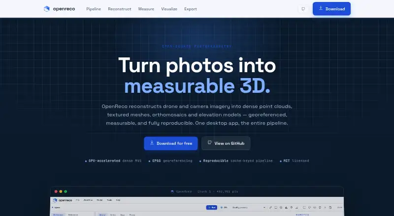
What OpenReco is
OpenReco converts drone and camera imagery into dense point clouds, textured meshes, orthomosaics, and elevation models. Its node-based workspace can run an entire reconstruction graph or individual stages, with results that are cached and reproducible. The software uses COLMAP CUDA for GPU multi-view stereo and describes an automatic CPU fallback. Models can be georeferenced from EXIF GPS data or ground control points. Analysis tools cover volume, profile, area, and distance measurements, along with vegetation maps using NDVI, ExG, and VARI. Listed output formats include LAS, LAZ, PLY, OBJ, GeoTIFF, GeoJSON, DXF, CSV, 3D Tiles, and contour SHP. OpenReco is MIT licensed and open source, with desktop downloads for Windows, macOS, and Linux. The site says it can be downloaded without an account or subscription; the free plan is free. Named target fields include surveying and mapping, agriculture and forestry, VFX and heritage, construction and earthworks, and robotics and research.
Good
- Reconstructs point clouds, meshes, and orthomosaics
- Supports georeferencing with EXIF GPS or control points
- Includes measurements and vegetation maps
- Exports GIS and 3D formats
Watch out
- Desktop downloads only for Windows, macOS, and Linux
- GPU multi-view stereo uses COLMAP CUDA
Who it suits
OpenReco suits people in surveying, mapping, agriculture, forestry, construction, VFX, heritage, robotics, or research who need to reconstruct and analyze imagery. It is available as a desktop download for Windows, macOS, and Linux.
Verdict
OpenReco offers an imagery reconstruction workflow with georeferencing, measurement, vegetation analysis, and a wide list of exports. It is open source and the site says no account or subscription is needed.
Plans and prices
From OpenReco's own pricing page, checked 15 Oct 2026.
| Plan | Price | What it gives you |
|---|---|---|
| Free | Free | No account · no subscription · Windows, macOS and Linux downloads |
The facts
Each one read from OpenReco's own pages, with the date it was checked.
What it does
- Account and subscription
- The site says users can download OpenReco with no account and no subscription.checked 4 Oct 2026
- Analysis
- Features include volume, profile, area, and distance measurements, plus NDVI, ExG, and VARI vegetation maps.checked 4 Oct 2026
- CLI
- The command line includes run, resume, diff, report, stages, batch, export, ui, volume and profile commands.checked 15 Oct 2026
- Dense reconstruction
- Dense multi-view stereo depth maps are fused into a high-density point cloud, using COLMAP CUDA with CPU fallback.checked 15 Oct 2026
- Desktop UI
- The UI provides a layer tree, schema-driven parameter panels, live run progress and a three.js 3D viewport.checked 15 Oct 2026
- Documentation depth
- The repository contains documentation covering discovery, product planning, architecture, pipeline specification and roadmap, plus a detailed README.checked 15 Oct 2026
- Elevation products
- The product can rasterize digital surface models and generate contours from elevation data.checked 15 Oct 2026
- Export formats
- Listed outputs include LAS, LAZ, PLY, OBJ, GeoTIFF, GeoJSON, DXF, CSV, 3D Tiles and contour shapefiles.checked 15 Oct 2026
- Exports
- Listed output formats include LAS, LAZ, PLY, OBJ, GeoTIFF, GeoJSON, DXF, CSV, 3D Tiles, and contour SHP.checked 4 Oct 2026
- Georeferencing
- Models can be positioned using EXIF GPS or ground-control points in an EPSG coordinate reference system.checked 15 Oct 2026
- GPU requirements
- NVIDIA dense processing requires the machine's NVIDIA driver and CUDA COLMAP; macOS uses CPU because it has no CUDA.checked 15 Oct 2026
- Install options
- The README describes standalone PyInstaller binaries plus installation from Python with pip and an optional bootstrap command.checked 15 Oct 2026
- Licence
- OpenReco is released under the MIT licence and its stated dependencies are restricted to permissive BSD, MIT, Apache or similar licences.checked 15 Oct 2026
- License
- The site describes OpenReco as MIT licensed and open source.checked 4 Oct 2026
- Limit: Gaussian splatting
- The Gaussian Splatting branch requires torch, gsplat, CUDA, nvcc, CUDA headers and a host C++ compiler, and is not validated on the developer's Windows machine.checked 15 Oct 2026
- Limit: maturity
- The README labels the project an incomplete v0.1.1 release and describes it as early even though the UAV pipeline is functional.checked 15 Oct 2026
- Limit: missing capabilities
- Multi-image texture blending, PBR, cloud collaboration, learned matching, USD/COPC/3D-Tiles streaming and full GUI collaboration are listed as not yet built or roadmap work.checked 15 Oct 2026
- Measurements
- Users can calculate cut/fill volume, elevation profiles, areas and distances directly on the model.checked 15 Oct 2026
- Mesh generation
- OpenReco reconstructs polygonal surfaces with Poisson meshing and can produce models with millions of vertices.checked 15 Oct 2026
- Neural extension
- An experimental 3D Gaussian Splatting stage trains from the SfM camera solution and exports a 3DGS PLY file.checked 15 Oct 2026
Where it runs
- Download platforms
- The site lists Windows, macOS, and Linux downloads.checked 4 Oct 2026
- Limit: approximate outputs
- Orthophoto processing is described as approximate and the DTM is based on morphological DSM processing.checked 15 Oct 2026
The company
- Maker
- The GitHub account identifies the maker as Abhishek Bagul, a full-stack web developer based in India.checked 15 Oct 2026
- Maker background
- The maker's profile says he previously worked as an aerial surveyor for three years.checked 15 Oct 2026
The full review of OpenReco
OpenReco is desktop photogrammetry software for turning drone and camera images into 3D models and mapping outputs. It is best suited to people who need reconstruction plus geospatial measurement or vegetation analysis; its open-source, no-subscription approach makes it a practical fit for that workflow.
Its breadth of exports and stage-by-stage processing are compelling, though the GPU-oriented reconstruction path and desktop-only deployment make it less suited to users seeking a web or mobile workflow.
Overview
OpenReco builds dense point clouds, textured meshes, orthomosaics, and elevation models from imagery. Its node-based workspace can run a complete reconstruction graph or individual stages, with cached results that support reproducible work. That flexibility is valuable when a project needs selective reruns, rather than repeating every processing stage.
COLMAP CUDA provides GPU multi-view stereo, with an automatic CPU fallback. The fallback broadens hardware compatibility, but users without a suitable GPU should expect the reconstruction path to rely on CPU processing instead.
Key features
Georeferencing and analysis
Models can be georeferenced from EXIF GPS or ground control points. For mapping and survey work, that connects image reconstruction to spatial reference rather than leaving outputs as unlocated 3D models. Measurement tools cover volume, profile, area, and distance; NDVI, ExG, and VARI maps add vegetation analysis for agriculture and forestry work.
Export formats
Exports include LAS and LAZ point clouds, PLY and OBJ models, GeoTIFF orthomosaics, GeoJSON, DXF, CSV, 3D Tiles, and contour SHP. This range makes OpenReco relevant to both GIS-oriented workflows and 3D content work, while the specific output format can be chosen for the next tool or deliverable.
Pricing
OpenReco is free: the Free plan costs nothing. It requires no account or subscription, and the MIT license makes it open source. There is no paid tier to weigh against a free cap or seat limit; the trade-off is that OpenReco is a desktop application, not a hosted service.
Platforms
OpenReco is a desktop app with downloads for Windows, macOS, and Linux. It supports orthophoto and point-cloud exports, ground control points, GIS data export, and API access. Its listed platform range suits desktop users across the major operating systems, but not readers looking for browser or mobile access.
Who it's for
OpenReco is aimed at surveying and mapping, agriculture and forestry, VFX and heritage, construction and earthworks, and robotics and research. The combination of georeferencing, measurements, vegetation indices, and broad export formats is most useful to people who need outputs beyond a textured model. It is a less natural choice for users who only want a lightweight image-to-3D tool or need a web-based workflow.
Pros and cons
Pros
- Reproducible, selective processing: the node graph can run end to end or stage by stage, and cached results avoid treating every run as a fresh start.
- Useful mapping and analysis tools: ground control points, spatial measurements, and vegetation maps extend the workflow beyond reconstruction.
- Wide export coverage: point clouds, GIS data, mesh formats, and 3D Tiles address varied downstream needs.
- No-cost open-source access: the MIT license and lack of account or subscription requirements remove payment and signup barriers.
Cons
- Desktop-only: there is no listed web or mobile platform for users who need to process or review work away from a desktop.
- GPU-first reconstruction: COLMAP CUDA is the primary multi-view stereo path; CPU fallback helps with compatibility but may not suit users prioritizing GPU-free processing.
Alternatives
For other options, see Photogrammetry Software.
- WebODM is a strong alternative for users who want a free local, offline workflow or web and API platform choices; paid Starter is $24 a month, billed yearly, for 12 maps per 30.
- 3DF Zephyr suits Windows users who want a personal-use free tier capped at 50 photos or video frames, with a single GPU and limited exports and editing.
- Agisoft Metashape is worth considering for users seeking a paid, node-locked license with a free trial; its Standard Edition is $179 a month.
- OpenDroneMap is another free option for Linux, macOS, Windows, or self-hosted use; its Standard plan costs $64, paid once and includes one year of installation support, updates, a per-user license, and a 30-day money-back guarantee.
- 3Dsurvey may suit readers who need Android or iOS alongside desktop and web platforms; its yearly subscription license is €187.50 a year, billed yearly in the amount of 2,250 €, excl. taxes.
- RealityScan is an alternative for readers who want a freemium option spanning Android, iOS, Linux, and Windows.
- PHOTOMOD is an alternative for readers considering a platform range that includes self-hosted and web deployment.
- KIRI Engine is an alternative for readers who prefer Android, iOS, or web access and a free Basic tier of up to 150 photos per scan.
Verdict
Choose OpenReco if you need desktop photogrammetry with georeferencing, practical measurement and vegetation tools, and exports that cover both GIS and 3D work, without a subscription. Its main reason to look elsewhere is deployment: users who need browser or mobile access should choose a platform built around those workflows instead.
Alternatives to OpenReco
- 1

WebODM
Free planOpen sourceWebAPILinuxmacOS8.3From $24 a month - 2

KIRI Engine
Free planAndroidiOSWebAPI8.1From $79.99 a year - 3
OpenMVG
Free planOpen sourceAndroidiOSAPILinux7.8Free plan - 4

Polycam
Free planAndroidiOSWeb7.5From $150 a year - 5
RealityScan
Free planAndroidiOSLinuxWindows7.4From $1,250 a year - 6
Scaniverse
Free planAndroidiOSWeb7.4From $20 a month