
MapTiler Cloud
MapTiler Cloud is a maps API for developers building web and mobile applications.
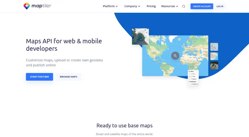
What MapTiler Cloud is
MapTiler Cloud is a maps API for developers building web and mobile applications. It lets users tailor map language, colors, and fonts, then publish branded maps online. Users can upload raster or vector geodata—including GeoTIFF, GeoJSON, and Shapefile—for automatic processing, or draw points, lines, polygons, and annotations in its editor and use the results through an API. Location tools search places and convert between addresses or place names and coordinates. The platform includes APIs for maps, tiles, static maps, geocoding, elevation, weather, IP geolocation, coordinates, and data. It supports raster tiles with Leaflet, OpenLayers, or XYZ, vector tiles with MapTiler SDK, and WMTS for QGIS or ArcGIS; Swift and Kotlin SDKs are available for native iOS and Android apps. The Free plan is for testing, personal, or non-commercial use and includes 5 GB storage, 5,000 sessions per month, and 100,000 API requests per month. When a Free quota is reached, service pauses until the next month unless the account is upgraded.
Good
- Customize map language, colors, and fonts.
- Upload and publish raster or vector geodata.
- Draw map features in the editor.
- Native Swift and Kotlin SDKs are available.
- Free plan includes 5,000 monthly sessions.
Watch out
- Free plan is limited to personal, testing, or non-commercial use.
- Service pauses when Free quota is reached.
- Flex usage can trigger automatic overuse charges.
Who it suits
It suits web and mobile developers who need customizable maps, geodata hosting, or location APIs. Teams building native iOS or Android apps can use the Swift and Kotlin SDKs.
Verdict
MapTiler Cloud combines map design, geodata tools, and location APIs for web and mobile projects. Check its plan quotas and overage behavior against your expected usage before choosing a paid tier.
Plans and prices
From MapTiler Cloud's own pricing page, checked 1 Oct 2026.
| Plan | Price | What it gives you |
|---|---|---|
| Free | Free | testing/personal/non-commercial · 5 GB storage (1 file) · 5k sessions/month · 100k API requests/month · 100 uploads/month |
| Flex | $30 a month | 10 GB storage · unlimited files · 25k sessions/month · 500k API requests/month · 1k uploads/month · 10 prints/month for internal use · Extra traffic billed monthly |
| Custom | Priced on request | custom quotas with soft limit · volume discounts · 99.9% SLA · team account · no automatic overuse bills · custom storage · Prepaid by invoice, credit card or bank transfer |
The facts
Each one read from MapTiler Cloud's own pages, with the date it was checked.
What it does
- API capabilities
- The Cloud platform includes static maps, coordinates, IP geolocation, elevation, weather, geocoding, maps, tiles, and data APIs.checked 1 Oct 2026
- Custom reliability
- Custom plan customers receive a 99.9% uptime service-level agreement.checked 1 Oct 2026
- Encryption
- Data in transit is secured with TLS 1.2 or 1.3 and sensitive data at rest is encrypted with AES-256.checked 1 Oct 2026
- Geodata hosting
- Raster or vector files such as GeoTIFF, GeoJSON, and Shapefile can be uploaded and processed automatically for online publishing.checked 1 Oct 2026
- Location services
- The service provides search and geocoding that converts place names and addresses to coordinates and coordinates to place names.checked 1 Oct 2026
- Map customization
- Users can switch language, change colors, and select fonts to design branded maps for web and mobile apps.checked 1 Oct 2026
- Mobile SDKs
- MapTiler Swift and Kotlin SDKs support native iOS and Android applications with built-in session-based billing.checked 1 Oct 2026
- Privacy compliance
- MapTiler says its data processing is governed by GDPR, the Swiss Federal Act on Data Protection, and CCPA, and that it acts as a customer data processor.checked 1 Oct 2026
- Product purpose
- MapTiler Cloud is a maps API for web and mobile developers to customize maps, upload or create geodata, and publish online.checked 1 Oct 2026
- Quota behavior
- When a Free plan quota is reached, service pauses until the next month unless the account is upgraded; Flex usage can incur automatic overuse charges.checked 1 Oct 2026
- Security certification
- MapTiler operates an information security management system certified to ISO/IEC 27001:2022 and says it is pursuing SOC 2 Type II compliance.checked 1 Oct 2026
- Support
- All MapTiler products include documentation and best-effort technical support, with a paid Premium Support package offering guaranteed response times and priority issue resolution.checked 1 Oct 2026
- Vector editing
- The editor lets users add points, lines, polygons, and annotations directly to a map and use the result through an API.checked 1 Oct 2026
The company
- Headquarters
- Unterägeri, Switzerlandchecked 28 Sep 2026
Where it runs
- Mapping integrations
- MapTiler supports raster tiles with Leaflet, OpenLayers, or XYZ, vector tiles with MapTiler SDK, and WMTS for QGIS or ArcGIS.checked 1 Oct 2026
The full review of MapTiler Cloud
MapTiler Cloud is a developer-focused mapping service for styling maps, hosting geographic data, and serving location APIs in web and mobile products. It suits teams that need branded, programmable maps and native mobile SDKs more than people making a single presentation map. The main buying decision is whether its quotas, billing behavior, and integration set match your expected traffic.
Overview
MapTiler Cloud combines map design with a hosted geodata workflow. You can change map language, colors, and fonts, upload geographic files, edit features on a map, and publish the result online or through an API. That makes it a practical foundation for an application whose map is part of the product rather than an isolated graphic.
The service is based in Unterägeri, Switzerland and offers web, API, Android, and iOS access. Its free tier is useful for testing, personal work, and non-commercial projects, while production users need to watch session and request quotas closely.
Key features
Map styling lets a team shape the visual identity of an app by selecting language, colors, and fonts. Raster and vector uploads, including GeoTIFF, GeoJSON, and Shapefile, are processed for online publication, reducing the need to operate a separate hosting pipeline. The editor adds points, lines, polygons, and annotations directly to a map; those edits can then be consumed through an API.
Location services cover search and geocoding in both directions: addresses or place names can become coordinates, and coordinates can resolve back to place names. APIs extend to static maps, IP geolocation, elevation, weather, maps, tiles, and data, giving developers several services under one account.
Integration choices are broad. Raster tiles work with Leaflet, OpenLayers, or XYZ, vector tiles work through MapTiler SDK, and WMTS connects with QGIS or ArcGIS. Swift and Kotlin SDKs support native iOS and Android apps, using session-based billing. Embedding is available through an iframe, and API access is included.
For organizations with compliance requirements, MapTiler operates an information security management system certified to ISO/IEC 27001:2022 and says it is pursuing SOC 2 Type II compliance. It describes processing under GDPR, the Swiss Federal Act on Data Protection, and CCPA, acts as a customer data processor, protects traffic with TLS 1.2 or 1.3, and encrypts sensitive data at rest with AES-256. Documentation and best-effort technical support come with all products; Premium Support adds guaranteed response times and priority issue resolution.
Pricing
Free — free is intended for testing, personal, and non-commercial use. It includes 5 GB of storage with one file, 5,000 sessions per month, 100,000 API requests per month, and 100 uploads per month. When the quota is reached, service pauses until the next month unless the account is upgraded. This is a sensible evaluation tier, but the single-file storage limit and non-commercial terms rule it out for many live products.
Flex — $30 a month adds 10 GB of storage, unlimited files, 25,000 sessions per month, 500,000 API requests per month, 1,000 uploads per month, and 10 prints per month for internal use. Extra traffic is billed monthly, so it offers more room for a growing project while introducing automatic overuse charges. It fits smaller commercial apps that can monitor usage and accept variable bills.
Custom — custom pricing is prepaid by invoice, credit card, or bank transfer. It provides custom quotas with a soft limit, volume discounts, a team account, custom storage, no automatic overuse bills, and a 99.9% uptime SLA. This is the appropriate route for larger deployments that need contractual reliability, predictable billing, or coordinated team access.
A free trial is available. The paid entry point is $30 per month, but Flex's traffic overage terms should be treated as part of the budget rather than an edge case.
Platforms
MapTiler Cloud supports Android, iOS, web, and direct API use. Native Swift and Kotlin SDKs make it relevant to mobile teams, while browser integrations and WMTS cover web and desktop GIS workflows.
Who it's for
Choose MapTiler Cloud for a web or mobile product that needs branded cartography, hosted spatial files, geocoding, and multiple map or location APIs in one platform. It is also well suited to teams already working with Leaflet, OpenLayers, MapTiler SDK, QGIS, or ArcGIS. It is a weaker fit for a casual map creator, a commercial project that cannot tolerate quota pauses, or a team unwilling to manage Flex overage exposure.
Pros and cons
Pros
- Complete developer stack: styling, uploads, editing, tiles, geocoding, and additional location APIs reduce the need to combine separate services.
- Strong data-format coverage: GeoTIFF, GeoJSON, and Shapefile uploads support common raster and vector workflows.
- Mobile-ready: Swift and Kotlin SDKs address native iOS and Android applications with session-based billing.
- Enterprise safeguards: ISO/IEC 27001:2022 certification, stated privacy-law coverage, TLS, and AES-256 support production governance.
Cons
- Free limits are restrictive: one file, 5,000 sessions, and non-commercial terms make it primarily an evaluation tier.
- Flex can surprise budgets: extra traffic is billed automatically each month.
- Custom pricing requires a sales decision: larger teams must move beyond published rates to obtain custom quotas and SLA terms.
Alternatives
Datawrapper is the better choice when charts, maps, and tables with web embedding and PNG downloads matter more than developer APIs and hosted geodata.
Felt suits personal collaborative mapping, especially if unlimited maps and sharing are more important than uploading your own data files.
Mapotic is a simpler map-builder option with a free tier offering 100 places, data layers, filters, ratings, and comments.
EasyMapMaker is aimed at straightforward pin-based maps, with a free allowance of 250 pins per map and 20 maps a day.
MapChart is a free-plan map-making alternative for users who do not need MapTiler Cloud's developer platform.
Maputnik is the appropriate alternative when a free, open-source visual editor that can run online, through CLI, or in Docker is the priority.
Scribble Maps fits lighter map annotation needs; its free plan allows five lifetime map saves for one user, while Pro Basic is $19 per month.
Visme is better suited to broader visual presentations and slides than to an API-led mapping backend.
For category browsing, see Map Creation Software and Interactive Map Software.
Verdict
MapTiler Cloud is a strong recommendation for developers building branded, data-rich maps across web and native mobile platforms. Its combination of geodata hosting, editing, integrations, and location APIs is the main reason to choose it. Look elsewhere if you need a casual map-making tool, cannot accept the Free tier's commercial and quota restrictions, or require predictable high-volume billing without moving to a custom contract.
Alternatives to MapTiler Cloud
- 1

Felt
Free planAndroidiOSWebAPI8.2From $199 a month - 2
Mapbox Studio
Free planAndroidiOSWebAPI7.7Free plan - 3
Cesium ion
Free planWebAPILinuxSelf-hosted7.2From $149 a month - 4

Global Mapper
AndroidiOSWindows6.9From $599 a year - 5

Google Earth Engine
Free planWebAPILinux6.9From $500 a month - 6

QGIS
Free planAndroidiOSLinuxmacOS6.9Free plan