uDig
The facts below are what the maker publishes about uDig, checked and dated. Our editors have not written about it yet.
The facts
Each one read from uDig's own pages, with the date it was checked.
What it does
- Architecture
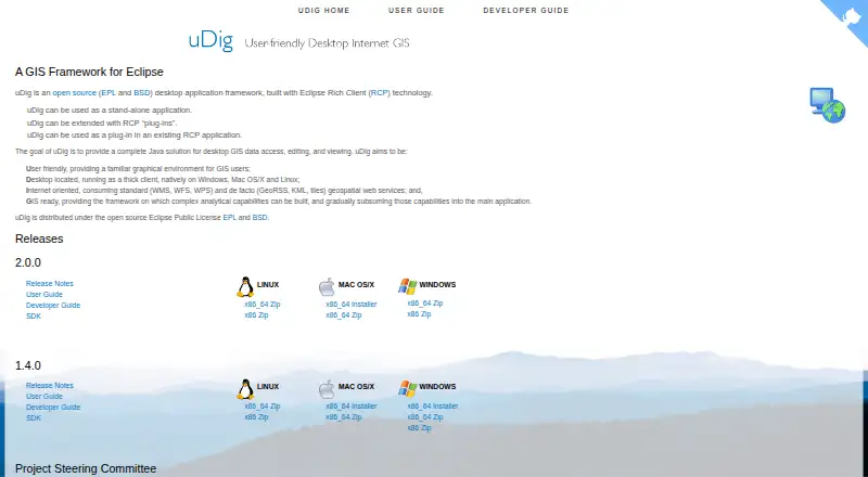
- uDig is built with Eclipse Rich Client technology and can run standalone, as an RCP plug-in, or be extended with RCP plug-ins.checked 9 Oct 2026
- Databases
- The user guide says uDig handles databases such as PostGIS, Oracle, and DB2.checked 8 Oct 2026
- Data sources
- The user guide documents adding layers from shapefiles, PostGIS, WMS, and WFS.checked 8 Oct 2026
- Deployment
- uDig can run as a standalone application, be extended with Eclipse RCP plug-ins, or be used as a plug-in in an existing RCP application.checked 8 Oct 2026
- File formats
- The user guide lists GeoTIFF, GML, Shapefile, and World Plus Image among supported spatial file formats.checked 9 Oct 2026
- Import and export
- The guide documents importing CSV and KML and exporting feature layers to KML and raster coverage to TIFF or ESRI ASCII.checked 8 Oct 2026
- License
- The project describes uDig as open source under the EPL and BSD licenses.checked 9 Oct 2026
- Licensing
- uDig is open source and distributed under the EPL and BSD licenses.checked 8 Oct 2026
- Local data handling
- Files are read from disk rather than imported into uDig, and the guide says moving data off network drives may improve performance.checked 9 Oct 2026
- Map editing
- The Map Editor lets users visualize and edit spatial information organized as layers.checked 9 Oct 2026
- Maps and editing
- The map editor lets users visualize and edit spatial information organized into layers.checked 8 Oct 2026
- Notable limit
- The file-format guide cautions that many GIS formats consist of multiple same-name files with different extensions, and says all files in a set should be copied together.checked 9 Oct 2026
- Project origin
- The user guide says uDig originated at Refractions Research in Canada with funding from GeoConnections Canada.checked 8 Oct 2026
- Purpose
- uDig is an open-source desktop GIS framework for accessing, editing, and viewing GIS data.checked 9 Oct 2026
- Release notes
- The uDig 2.0 page describes that release as a bug-fix release and says it upgraded GeoTools to the 14.1.x series.checked 9 Oct 2026
- Spatial operations
- The Spatial Operations extensions include buffer, clip, dissolve, fill, hole cut, intersect, polygon-to-line, spatial join, and split operations.checked 9 Oct 2026
- Spatial toolbox
- The Spatial Toolbox can execute tools from loaded libraries on resources displayed in uDig; the guide describes loading OMS3-based JGrasstools modules.checked 9 Oct 2026
- Styling
- The Style Editor supports editing layer appearance and importing or exporting SLD style settings.checked 9 Oct 2026
- Support
- The project lists a user mailing list, developer mailing list, issue tracker, and IRC channel #udig as community resources.checked 9 Oct 2026
- Web services
- The project says uDig consumes geospatial services including WMS, WFS, WPS, GeoRSS, KML, and tiles.checked 9 Oct 2026
Where it runs
- Desktop platforms
- The project describes uDig as a thick client running natively on Windows, Mac OS/X, and Linux.checked 9 Oct 2026
Money
- License cost
- The user guide says the EPL and BSD licenses allow organizations to use the project with no per-seat license.checked 8 Oct 2026
Alternatives to uDig
- 1

Felt
Free planAndroidiOSWebAPI8.2From $199 a month - 2
NASA WorldWind
Free planOpen sourceAndroidWebAPILinux7.9Free plan - 3

Maptitude
AndroidiOSWebAPI7.8From $795 a year - 4
Mapbox Studio
Free planAndroidiOSWebAPI7.7Free plan - 5
StatSilk
Free planAndroidiOSWebAPI7.7From $495 a year - 6

GIS Cloud
Free planAndroidiOSWebAPI7.5From $5 a month