
GeoDesk
GeoDesk is a spatial database engine for working with OpenStreetMap data on Linux, macOS, and Windows.
What GeoDesk is
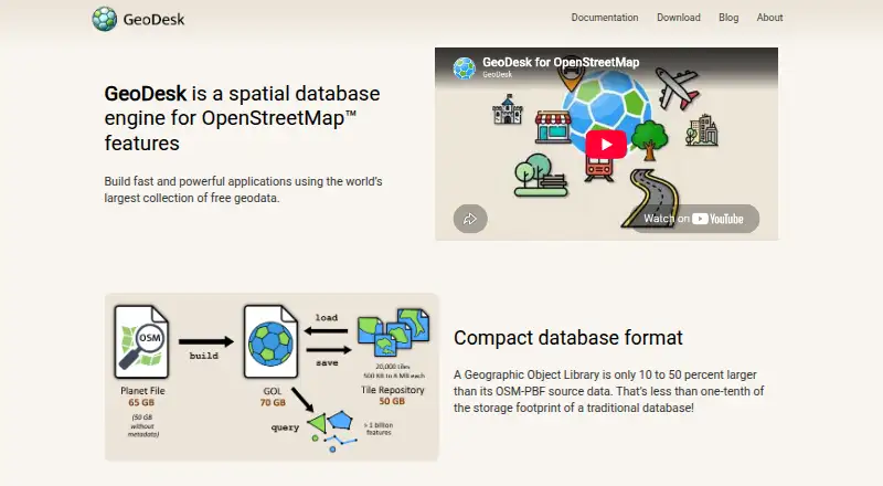
GeoDesk is a spatial database engine for working with OpenStreetMap data on Linux, macOS, and Windows. It stores OSM features, geometries, and relations in single-file Geographic Object Libraries (GOLs), which can be built from OSM-PBF files with its command-line tool. GeoDesk says these files are typically about 40 percent larger than OSM-PBF data but occupy a small fraction of the space used by a traditional database. It reports that common spatial queries run 50 times faster than their SQL equivalents. GOQL, its query syntax, organizes searches around feature types and tags. A GOL can also be converted into a compressed tile repository for downloading selected regions. Developers can use tools and guides for Java, Python, and C++, plus documented integrations with Java Topology Suite and Python Shapely for vector operations. Python mapping features can show queried data in a browser or save a Leaflet-based map as HTML. GeoDesk is free and open-source; its site links to documentation, tutorials, repositories, and API references.
Good
- Free and open-source.
- Stores OSM geometries and relations in GOL files.
- GOQL queries use feature types and tags.
- GOLs can be converted to regional tile repositories.
- Python mapping can save Leaflet maps as HTML.
Watch out
- Python quickstart requires Python 3.7 or higher.
- Building the C++ library requires C++20 and CMake 3.14 or later.
Who it suits
GeoDesk suits developers building applications or conducting geospatial analysis with OpenStreetMap data. It offers options for Java, Python, and C++ users, as well as a command-line tool.
Verdict
GeoDesk combines an OSM-focused data format, query language, and developer tooling in a free package. Check its language requirements and supported development options against your project before choosing it.
Plans and prices
From GeoDesk's own pricing page, checked 30 Sep 2026.
| Plan | Price | What it gives you |
|---|---|---|
| GeoDesk | Free | 100% free and open-source |
The facts
Each one read from GeoDesk's own pages, with the date it was checked.
What it does
- Affiliation
- GeoDesk says it is not affiliated with, endorsed by, or sponsored by OpenStreetMap.checked 30 Sep 2026
- Audience
- GeoDesk describes its intended use as building fast applications and performing geospatial analysis with OpenStreetMap data.checked 30 Sep 2026
- Build requirements
- Building the C++ library requires a C++20-capable compiler and CMake 3.14 or later.checked 30 Sep 2026
- Data format
- GeoDesk stores OSM data in single-file Geographic Object Libraries (GOLs).checked 30 Sep 2026
- Data import
- The GOL tool builds libraries from OpenStreetMap PBF files.checked 30 Sep 2026
- Developer libraries
- GeoDesk provides Python, Java and C++ options alongside its command-line GOL tool.checked 30 Sep 2026
- Geometry integrations
- GeoDesk documents integration with Java Topology Suite and Python Shapely for vector operations including buffers, unions, and triangulation.checked 30 Sep 2026
- Hardware
- GeoDesk says it performs well on systems that can run 64-bit Java or Python.checked 30 Sep 2026
- Integrations
- GeoDesk documents integration with Java Topology Suite and Python Shapely for vector operations.checked 30 Sep 2026
- Languages
- GeoDesk provides tooling and developer guides for Java, Python, and C++, plus a GOL command-line utility.checked 30 Sep 2026
- OSM model
- GOLs store geometries and support OpenStreetMap concepts such as relations.checked 30 Sep 2026
- OSM support
- GOLs store shapes and support OpenStreetMap concepts including relations.checked 30 Sep 2026
- Purpose
- GeoDesk is a spatial database engine for OpenStreetMap features.checked 30 Sep 2026
- Python requirement
- The Python quickstart says Python 3.7 or higher is required.checked 30 Sep 2026
- Query language
- GeoDesk provides GOQL, a concise query syntax based on feature types and tags and similar to MapCSS.checked 30 Sep 2026
- Query performance
- GeoDesk says its queries are typically 50 times faster than SQL queries.checked 30 Sep 2026
- Query speed
- The most common spatial queries perform fifty times faster than their SQL equivalents, according to GeoDesk.checked 30 Sep 2026
- Regional data
- A GOL can be turned into a compressed tile repository so users can download only the regions they need.checked 30 Sep 2026
- Storage
- Geographic Object Libraries are single files typically about 40 percent larger than OSM-PBF data and a small fraction of a traditional database’s footprint.checked 30 Sep 2026
- Support
- The official site links to documentation, tutorials, GitHub repositories, and API references for its tools and language libraries.checked 30 Sep 2026
The company
- Maker
- GeoDesk describes its maker as an independent team of developers interested in cartography and geospatial topics.checked 30 Sep 2026
- Maker details
- The About page does not state the maker’s headquarters or founding year.checked 30 Sep 2026
Where it runs
- Mapping
- The Python Map feature creates Leaflet-based web maps that can be saved as HTML or shown in a browser.checked 30 Sep 2026
- Platform support
- The C++ toolkit documentation lists 64-bit Windows, Linux and macOS support.checked 30 Sep 2026
The full review of GeoDesk
Overview
GeoDesk is a spatial database engine built around OpenStreetMap data, with its own storage format and query language. It suits developers and analysts building OSM-focused tools who want a compact, self-hosted alternative to querying a traditional database. Its main trade-off is specialization: the format and tooling are designed for OSM workflows rather than general-purpose data management.
Key features
GeoDesk stores OSM data in single-file Geographic Object Libraries (GOLs), built from OSM-PBF files with its command-line tool. GOLs hold geometries and OSM concepts such as relations. Their typical size—about 40 percent larger than OSM-PBF but a small fraction of a traditional database’s footprint—makes them practical to distribute as individual files, though they are not as compact as the source data.
GeoDesk says its most common spatial queries run 50 times faster than their SQL equivalents. That performance claim is most relevant to workloads that fit its feature-and-tag query model; GOQL is a concise syntax similar to MapCSS, rather than SQL. GOLs can also be converted into compressed tile repositories, allowing users to download only the regions they need.
For geometry work, GeoDesk documents connections to Java Topology Suite and Python Shapely, including operations such as buffers, unions and triangulation. Python can display queried features in a Leaflet-based web map, saved as HTML or opened in a browser. Coordinate transforms are supported, but GeoDesk does not support 3D geometry.
Developer tooling covers Java, Python and C++, alongside the GOL command-line utility. The Python quickstart requires Python 3.7 or later. Building the C++ library requires a C++20-capable compiler and CMake 3.14 or later, so that route has a more demanding setup than using a ready-to-run language library.
Pricing
GeoDesk costs nothing. The plan is 100% free and open-source, with no free trial or paid plan described. That removes subscription cost for individual developers and teams willing to host and operate the software themselves; it is not a hosted service.
Platforms
GeoDesk supports Linux, macOS and Windows. The C++ toolkit specifically documents 64-bit support on all three. GeoDesk says it performs well on systems able to run 64-bit Java or Python, while Python users need version 3.7 or later.
Who it's for
GeoDesk is a strong fit for developers building fast applications around OpenStreetMap and for analysts doing geospatial work on OSM features. Its compact single-file libraries, regional tile repositories and language options make it useful when data needs to be queried or shared by region. It is a weaker fit for projects centered on 3D geometry, or for teams that need a managed database rather than self-hosted software.
Documentation, tutorials, GitHub repositories and API references support its tools and language libraries. GeoDesk describes its maker as an independent team interested in cartography and geospatial topics, and says it is not affiliated with, endorsed by or sponsored by OpenStreetMap.
Pros and cons
- Pro: The free, open-source plan avoids licensing costs while giving developers Java, Python, C++ and command-line options.
- Pro: GOLs preserve OSM-specific concepts such as relations, and can be packaged as compressed regional tile repositories.
- Pro: The documented Shapely and Java Topology Suite integrations extend the workflow to common vector operations.
- Con: GeoDesk’s format and GOQL are specialized for OpenStreetMap, so teams seeking a general-purpose SQL database may be better served elsewhere.
- Con: GeoDesk does not support 3D geometry, limiting its use for workflows that require it.
- Con: The C++ build requires a C++20 compiler and CMake 3.14 or later, adding setup requirements for that option.
Alternatives
For other spatial database options, browse Spatial Databases.
Choose rasdaman if you want a freemium option with API, Linux, self-hosted and web platforms; its Community edition is free and open-source. MySQL is a better candidate when a project calls for a database with SQL and NoSQL applications, replication and high-availability components, and connectors; its Community Edition is GPL-licensed and the product offers a free plan and trial.
GeoMesa offers a free, Apache License 2.0 suite of tools for teams looking for a broader open-source geospatial toolkit. Pick Tile38 if its MIT-licensed, fully open-source option better fits your requirements. MonetDB is another free, open-source database, under the Mozilla Public License 2.0.
SedonaDB is a free, open-source single-node engine with Linux and self-hosted support, making it an option for teams whose needs align with that deployment model. Consider CrateDB if a freemium database is preferable and a shared free plan capped at 2 vCPUs, 2 GiB RAM and 8 GiB storage is sufficient. RavenDB is another freemium alternative, with developer and community plans described in terms of cores, RAM and nodes.
Verdict
Choose GeoDesk for OSM-centered applications and analysis when a free, self-hosted engine, compact GOL files and developer-language choices matter more than SQL familiarity or 3D support. Its strongest reason to choose it is the combination of OSM-aware storage and fast spatial queries; look elsewhere if you need a general-purpose database or managed hosting.
Alternatives to GeoDesk
- 1
CrateDB
Free planOpen sourceWebAPILinuxmacOS8.4Free plan - 2
SingleStore Helios
Free planWebAPILinuxmacOS8.1Free plan - 3

ClickHouse Cloud
Open sourceWebAPILinuxmacOS7.9From $25.30 a month - 4

MySQL
Free planAPILinuxmacOSSelf-hosted7.9Free plan - 5
Virtuoso Universal Server
Open sourceWebAPILinuxmacOS7.9From $99.99 a year - 6

Apache Solr
Free planOpen sourceWebAPILinuxmacOS7.7Free plan