WhiteboxTools
WhiteboxTools is a geospatial software suite for terrain analysis, hydrology, LiDAR, remote sensing, and vector GIS.
What WhiteboxTools is
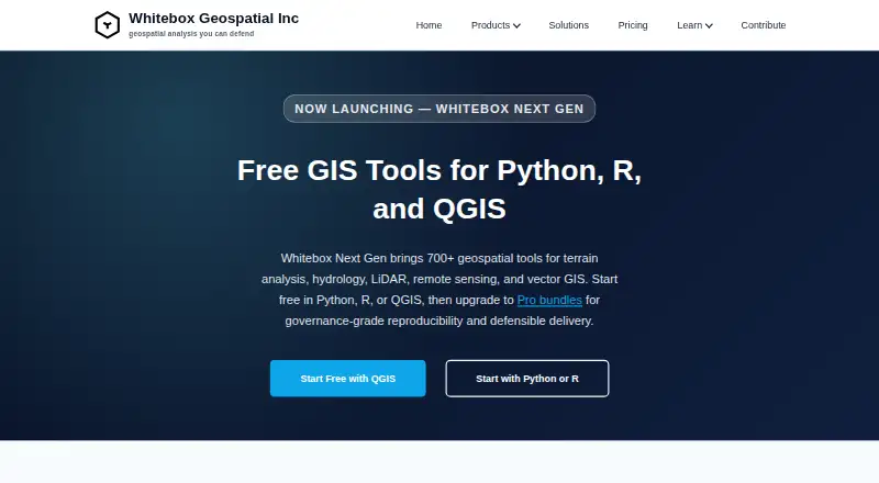
WhiteboxTools is a geospatial software suite for terrain analysis, hydrology, LiDAR, remote sensing, and vector GIS. Its Whitebox Next Gen library offers more than 700 tools, including digital elevation model terrain derivatives, watershed delineation, flow routing, point-cloud classification, image analysis, change detection, and vector operations. The open tools are available through Python, R, and a QGIS plugin, and can fit into notebooks, scripts, and local desktop workflows. Supported formats include GeoTIFF, Cloud-Optimized GeoTIFF, LAS/LAZ, COPC, GeoPackage, FlatGeobuf, GeoParquet, GeoJSON, and Shapefile. Whitebox lists support for Windows, macOS, and Linux. Processing runs locally, which may suit on-premises or offline environments. The open core is free; paid Entry plans range from $740 a year to $995 a year, and Standard plans range from $1,270 a year to $1,795 a year. The Pro EULA describes optional telemetry users can disable, while license-validation reporting cannot be disabled.
Good
- More than 700 geospatial tools
- Available through Python, R, and QGIS
- Supports Windows, macOS, and Linux
- Processes data locally
- Open core is free
Watch out
- License-validation reporting cannot be disabled
- Pro EULA restricts hosted and cloud deployments without written authorization
- Paid Entry plans start at $740 a year
Who it suits
WhiteboxTools suits GIS practitioners who need terrain, hydrology, LiDAR, or vector-analysis tools in Python, R, or QGIS workflows. Local processing may also suit teams with on-premises or offline needs.
Verdict
WhiteboxTools combines a broad geospatial tool library with several ways to integrate it into local workflows. Review the Pro license terms and paid plan details if you need hosted services or support beyond the community option.
Plans and prices
From WhiteboxTools's own pricing page, checked 3 Oct 2001.
| Plan | Price | What it gives you |
|---|---|---|
| Whitebox Open Core (Python, R, QGIS) | Free | Free/open tools; 700+ tools; Python, R, or QGIS |
| LiDAR & Forest Analytics — Entry | $740 a year | Annual subscription; Entry tier; per-user license · per user, per year |
| Environmental Risk & Compliance — Entry | $890 a year | Annual subscription; Entry tier; per-user license · per user, per year |
| Network Planning & Operations — Entry | $995 a year | Annual subscription; Entry tier; per-user license · per user, per year |
| LiDAR & Forest Analytics — Standard | $1,270 a year | Annual subscription; Standard tier; per-user or small team packs · per user, per year |
| Environmental Risk & Compliance — Standard | $1,490 a year | Annual subscription; Standard tier; per-user or small team packs · per user, per year |
| Network Planning & Operations — Standard | $1,795 a year | Annual subscription; Standard tier; per-user or small team packs · per user, per year |
| Environmental Risk & Compliance — Enterprise | Priced on request | Enterprise tier; custom pricing · custom |
| LiDAR & Forest Analytics — Enterprise | Priced on request | Enterprise tier; custom pricing · custom |
| Network Planning & Operations — Enterprise | Priced on request | Enterprise tier; custom pricing · custom |
The facts
Each one read from WhiteboxTools's own pages, with the date it was checked.
The company
- Company
- The maker is Whitebox Geospatial Inc., which lists Guelph, Canada as its location.checked 3 Oct 2001
- Headquarters
- Guelph, Canadachecked 28 Sep 2001
What it does
- Execution and data control
- The company says processing runs locally and that workflows can suit on-premises or offline environments.checked 3 Oct 2001
- File formats
- Listed formats include GeoTIFF, Cloud-Optimized GeoTIFF, LAS/LAZ, COPC, GeoPackage, FlatGeobuf, GeoParquet, GeoJSON, and Shapefile.checked 3 Oct 2001
- Geospatial functions
- Features include DEM terrain derivatives, watershed delineation, flow routing, point-cloud classification, image analysis, change detection, and vector operations.checked 3 Oct 2001
- Integrations
- Whitebox works with QGIS, Python notebooks, R workflows, scripts, and local desktop processing.checked 3 Oct 2001
- Interfaces
- The open tools are available through Python, R, and a QGIS plugin.checked 3 Oct 2001
- License limits
- The Pro EULA restricts hosted access, SaaS, embedded systems, cloud deployments, and automated batch-processing services unless the company expressly authorizes them in writing.checked 3 Oct 2001
- Operating systems
- The site lists Windows, macOS, and Linux support.checked 3 Oct 2001
- Purpose
- Whitebox provides geospatial tools for terrain analysis, hydrology, LiDAR, remote sensing, and vector GIS.checked 3 Oct 2001
- Security and privacy
- The Pro EULA says the software may collect non-personally identifiable usage statistics, performance metrics, and error logs; users may opt out of optional telemetry but not license-validation reporting.checked 3 Oct 2001
- Support
- Entry includes best-effort community support, Standard includes a priority support queue during business hours, and Enterprise support is available by agreement.checked 3 Oct 2001
- Tool library
- Whitebox Next Gen provides more than 700 geospatial tools.checked 3 Oct 2001
The full review of WhiteboxTools
WhiteboxTools is a local geospatial toolkit for terrain, hydrology, LiDAR, remote sensing, and vector GIS work. It best suits analysts who want a large library of tools integrated with Python, R, or QGIS. Its free open tools are a strong starting point; teams considering Pro should weigh the annual per-user cost and license restrictions.
Overview
Whitebox Next Gen brings more than 700 geospatial tools into workflows built around QGIS, Python notebooks, R, scripts, or local desktop processing. Its scope ranges from DEM derivatives and watershed delineation to point-cloud classification, image analysis, change detection, and vector operations. That breadth makes it useful as a versatile processing toolkit, especially for users who already work in the supported GIS and scripting environments.
Processing runs locally, and the company says workflows can suit on-premises or offline environments. That is a practical fit where data needs to stay within a local workflow. The Pro EULA permits collection of non-personally identifiable usage statistics, performance metrics, and error logs; optional telemetry can be disabled, but license-validation reporting cannot.
Key features
- Broad tool library: More than 700 tools cover terrain analysis, hydrology, LiDAR, remote sensing, and vector GIS. That range can reduce the need to switch among specialized tools for common geospatial operations.
- Multiple entry points: Open tools are available through Python, R, and a QGIS plugin. This suits both scripting-led analysis and GIS desktop workflows, though the product is not presented as a hosted service.
- Point-cloud and raster support: Point-cloud classification sits alongside image analysis and change detection, while listed formats include GeoTIFF, Cloud-Optimized GeoTIFF, LAS/LAZ, COPC, GeoPackage, FlatGeobuf, GeoParquet, GeoJSON, and Shapefile. That makes the toolkit relevant to mixed data workflows.
- Local execution: Desktop processing on Windows, macOS, and Linux supports on-premises and offline use. Pro users should note that hosted access, SaaS, embedded systems, cloud deployments, and automated batch-processing services are restricted unless expressly authorized in writing.
Pricing
The Open Core plan is free and includes the free/open tools, 700+ tools, and access through Python, R, or QGIS. It is the clearest choice for individuals and teams that can work with the open tools and community support.
Paid plans are annual subscriptions billed per user. Entry costs $740 a year for LiDAR & Forest Analytics, $890 a year for Environmental Risk & Compliance, and $995 a year for Network Planning & Operations. Entry includes best-effort community support, so the main stated support step-up is not part of this tier.
Standard costs $1,270 a year for LiDAR & Forest Analytics, $1,490 a year for Environmental Risk & Compliance, and $1,795 a year for Network Planning & Operations. It adds a priority support queue during business hours and is offered per user or in small team packs. Enterprise plans for all three areas have custom pricing and support by agreement, making them the route for organizations that need an enterprise arrangement.
A free trial is offered. Review the Pro license terms before choosing a paid tier if the intended workflow involves cloud deployment, hosted access, SaaS, embedding, or automated batch processing: those uses require written authorization. The license is also billed per user or team pack rather than as one flat price for an organization.
Platforms
WhiteboxTools supports Windows, macOS, and Linux. Its desktop processing and local execution make those platforms a good fit for users who want to run analysis on their own machines or within on-premises workflows.
Who it's for
WhiteboxTools is best suited to GIS analysts, researchers, and geospatial teams who need varied terrain, hydrology, LiDAR, raster, or vector operations and already use Python, R, QGIS, or local scripts. The free plan is a sensible first choice for users comfortable with community support. Standard is more appropriate when priority business-hours support matters; Enterprise is the option for buyers who need support by agreement or a custom arrangement.
It is a weaker fit for buyers seeking a hosted analytics service or planning to embed the tools, run cloud deployments, or offer automated batch processing without first securing written authorization. Its paid plans also price by user, which may matter to larger teams.
Pros and cons
- Pro: More than 700 tools span several geospatial disciplines, giving users a broad local processing toolkit rather than a narrow point-cloud utility.
- Pro: Python, R, and QGIS access accommodates both code-driven and desktop GIS workflows.
- Pro: Local processing and support for on-premises or offline workflows suit settings where data control is important.
- Con: Pro licensing restricts hosted, SaaS, embedded, cloud, and automated batch-service use without written authorization, limiting deployment flexibility.
- Con: Standard and Entry annual prices are per user, so costs rise with seats; Entry also lacks the priority support queue offered by Standard.
- Con: Pro permits license-validation reporting even when users opt out of optional telemetry, which may not suit every privacy requirement.
Alternatives
For more options, browse Point Cloud Software.
- Point Cloud Library is a free option for commercial and research use under a BSD license, with support for Android as well as desktop operating systems. Consider it when point-cloud work is the priority and a free license is important.
- LidarView is free and open source under Apache 2.0, with Linux and Windows support. It is an alternative for readers seeking a no-fee open-source option on those platforms.
- Open3D is free and supports API, Linux, macOS, self-hosted, web, and Windows platforms. Choose it when that platform range better matches the intended workflow.
- LP360 offers a free plan and web or Windows access. Its DJI L1/L2 Cloud batch processing plan costs $620 a year, requires LP360 Drone, and includes 20 flights per month for one user; consider it when that defined cloud-processing allowance fits the workload. Cloud Collaborate costs $930 a year.
- Leica Cyclone 3DR is a paid Windows alternative with a free plan.
- Pointly has a free plan and supports API, self-hosted, and web use. Its usage-based Pointly Box pricing starts at 0.03 € per once, billed from 0.03 € per million points with volume booked in advance and unlimited parallel jobs; consider it when that usage model suits the project.
- PointCab Origins is a paid macOS and Windows option with a free trial. Its Origins Core monthly rental costs €420 a month.
- PDAL is a free alternative for Linux, macOS, and Windows.
Verdict
Choose WhiteboxTools if you want a broad geospatial tool library that runs locally and fits Python, R, or QGIS workflows; its free open tools make it accessible before committing to a paid tier. Look elsewhere if hosted or cloud use is central and you cannot obtain written authorization, or if per-user subscriptions and the Entry tier's community support do not fit your team.
Getting started
- Visit the WhiteboxTools website.
- Select the free open core or a listed paid subscription plan.
- Use the tools through Python, R, or the QGIS plugin.
- Install or run the software on Windows, macOS, or Linux.
Limits worth knowing
The free open core is identified as free, with 700+ tools and Python, R, or QGIS access. The least expensive listed paid subscription is LiDAR & Forest Analytics — Entry at $740 a year per user; Entry includes best-effort community support.
Questions
Is WhiteboxTools free?
Its open core plan is free and includes more than 700 tools accessible through Python, R, or QGIS.
What do paid plans cost?
Listed Entry subscriptions range from $740 a year to $995 a year per user. Listed Standard subscriptions range from $1,270 a year to $1,795 a year; Enterprise pricing is custom.
Which operating systems are supported?
The site lists Windows, macOS, and Linux support.
Can WhiteboxTools be used locally or offline?
The company says processing runs locally and that workflows can suit on-premises or offline environments.
What integrations are named?
WhiteboxTools works with QGIS, Python notebooks, R workflows, scripts, and local desktop processing.
What are the telemetry and license limits?
The Pro EULA says it may collect non-personally identifiable usage statistics, performance metrics, and error logs. Optional telemetry can be disabled, but license-validation reporting cannot; certain hosted, SaaS, embedded, cloud, and automated batch uses require written authorization.
Alternatives to WhiteboxTools
- 1

Global Mapper
AndroidiOSWindows6.8From $49.92 a month - 2

Open3D
WebAPILinuxmacOS6.3 - 3
Point Cloud Library
Free planAndroidLinuxmacOSWindows6.3Free plan - 4
PointCab Origins
macOSWindows6.3From €420 a month - 5
Terrasolid TerraScan
Windows6.2From €47.50 a month - 6

LP360
WebWindows6.1From $51.67 a month