
LP360
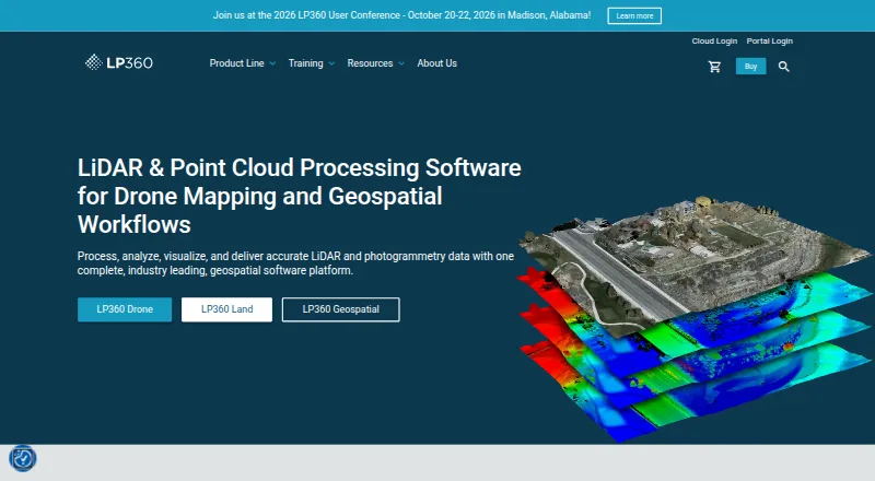
LP360 Drone is desktop software for processing, analyzing, and creating deliverables from drone LiDAR and imagery data.
What LP360 is
LP360 Drone is desktop software for processing, analyzing, and creating deliverables from drone LiDAR and imagery data. It provides synchronized 2D, 3D, and profile views, plus 3D Gaussian Splat viewing. Tools include LiDAR quality control and repair, filtering, 3D editing, automated ground classification, terrain models, and volume calculations. AI add-ons classify ground and above-ground features, extract forestry outputs, and identify utility corridor features. LP360 supports sensors including DJI, Microdrones, Phoenix LiDAR, Riegl, TrueView, Wingtra, and YellowScan, and can combine data with other geospatial sources. It supports CAD formats and LANDXML export; its LPLAS files follow the ASPRS LAS specification and work with software that reads LAS. The Drone license is a floating license for one device and limits project size to 10km². Core processing is local, with optional user-initiated cloud workflows, and offline or air-gapped operation is supported. A free plan is listed; LP360 Drone costs $1,675 USD per year.
Good
- Synchronized 2D, 3D, and profile views
- Tools include terrain models and volume calculations
- Supports sensors from multiple listed manufacturers
- Offline or air-gapped use supported
- Exports include CAD formats and LANDXML
Watch out
- Drone license limited to one device
- Projects limited to 10km²
- LP360 Drone costs $1,675 USD per year
Who it suits
LP360 Drone suits users working with drone LiDAR and imagery who need processing, analysis, and deliverables. Its local processing and offline operation may suit users who need to avoid external data transmission in that mode.
Verdict
LP360 Drone brings point-cloud and imagery processing tools together with local processing and optional cloud workflows. The one-device license and 10km² project limit are important constraints to weigh.
Plans and prices
From LP360's own pricing page, checked 29 Sep 2001.
| Plan | Price | What it gives you |
|---|---|---|
| DJI L1/L2 Cloud batch processing | $620 a year | Requires LP360 Drone · 20 flights per month · 1 user included · usd 620 / year |
| Cloud Collaborate | $930 a year | Requires LP360 Drone · 200GB storage · 1 user · streaming up to 50GB/month · usd 930 / year |
| 3D Accuracy | $1,115 a year | Requires LP360 Drone · usd 1,115 / year |
| AI Ground Classification | $1,360 a year | Requires LP360 Drone · 5 regular jobs per month (0–10GB project) · 1 user included · usd 1,360 / year |
| LP360 Drone | $1,675 a year | one-device floating license · project size limited to 10km² · $1,675 usd / year |
| Strip Align for Drone | $1,675 a year | Requires LP360 Drone · usd 1,675 / year |
| 3D Photo Engine | $2,475 a year | Requires LP360 Drone · usd 2,475 / year |
| AI Ground+ Classification | $2,640 a year | Requires LP360 Drone · 5 regular jobs per month (0–10GB project) · 1 user included · standalone AI Ground Classification not included · usd 2,640 / year |
| AI Forestry Classification | $5,280 a year | Requires LP360 Drone · 5 regular jobs per month (0–10GB project) · 1 user included · usd 5,280 / year |
The facts
Each one read from LP360's own pages, with the date it was checked.
What it does
- AI classification
- Its AI add-ons classify ground and above-ground features, extract forestry outputs, and identify utility corridor features.checked 29 Sep 2001
- Cloud collaboration
- The Cloud Collaborate add-on provides online storage, sharing, geographic search, web viewing, and streaming from LP360 Cloud and desktop software.checked 29 Sep 2001
- Exports
- LP360 supports CAD formats and LANDXML export, and its LPLAS files follow the ASPRS LAS specification and are compatible with software that reads LAS.checked 29 Sep 2001
- Hosting and retention
- LP360 Online services are hosted on AWS in the United States; certain workflows may temporarily transfer data to third-party processors, including servers in France.checked 29 Sep 2001
- Integrations
- The product supports sensors including DJI, Microdrones, Phoenix LiDAR, Riegl, TrueView, Wingtra, and YellowScan, and can combine data with other geospatial sources.checked 29 Sep 2001
- Offline operation
- LP360 says it supports offline or air-gapped use, with local processing and no external data transmission in that mode.checked 29 Sep 2001
- Processing tools
- Features include LiDAR quality control and repair, filtering, 3D editing, automated ground classification, terrain models, and volume calculations.checked 29 Sep 2001
- Purpose
- LP360 Drone processes, analyzes, and creates deliverables from drone LiDAR and imagery data.checked 29 Sep 2001
- Security
- LP360 describes itself as local-first: core processing is local, cloud workflows are optional and user-initiated, and cloud transfers use HTTPS/TLS encryption.checked 29 Sep 2001
- Support
- GeoCue lists a technical support phone number of 1-256-715-5091 and provides a help and knowledge base and community forum.checked 29 Sep 2001
- Usage limit
- The LP360 Drone license is a desktop application with a floating license for one device and a 10km² project size limit.checked 29 Sep 2001
- Visualization
- The desktop product provides synchronized 2D, 3D, and profile views, plus 3D Gaussian Splat viewing.checked 29 Sep 2001
The company
- Company
- GeoCue says LP360 was founded by QCoherent, acquired by GeoCue in 2009, and is now developed in-house at GeoCue.checked 29 Sep 2001
- Founded
- 2003checked 28 Sep 2001
- Headquarters
- Madison, Alabama, United Stateschecked 28 Sep 2001
The full review of LP360
Overview
LP360 Drone is a desktop toolkit for turning drone LiDAR and imagery into analyzed data and project deliverables. It suits geospatial operators who need processing and analysis alongside visualization, rather than a viewer alone. Its one-device floating license and 10km² project ceiling put a firm boundary around that capability.
Key features
LP360 brings synchronized 2D, 3D, and profile views together with 3D Gaussian Splat viewing. Its processing tools cover LiDAR quality control and repair, filtering, 3D editing, automated ground classification, terrain modeling, and volume calculations. That breadth makes it useful for projects that move from point-cloud cleanup to measurable outputs; teams that only need to inspect point clouds may find the paid desktop suite more than they need.
Optional AI add-ons classify ground and above-ground features, produce forestry outputs, and identify utility-corridor features. Support for sensors from DJI, Microdrones, Phoenix LiDAR, Riegl, TrueView, Wingtra, and YellowScan, plus the ability to combine data with other geospatial sources, gives it a place in mixed-source workflows. It supports registration, classification, geospatial analysis, E57 and LAS/LAZ, and point-cloud-to-mesh work. Exports include CAD formats and LANDXML; LPLAS files follow the ASPRS LAS specification, making them usable in software that reads LAS.
Cloud Collaborate adds online storage, sharing, geographic search, web viewing, and streaming between LP360 Cloud and desktop software. Core processing is local, while cloud workflows are optional and user-initiated; transfers use HTTPS/TLS encryption. LP360 supports offline or air-gapped operation with local processing and no external data transmission in that mode. Online services are hosted on AWS in the United States, though some workflows may temporarily send data to third-party processors, including servers in France. Buyers with strict data-handling requirements should account for that distinction.
Pricing
LP360 is freemium, with a free plan and paid plans billed annually. The LP360 Drone base license costs $1,675 USD per year and includes a one-device floating license, with projects capped at 10km². It is the core choice for operators who need the desktop processing suite and can work within those limits.
Optional plans require LP360 Drone unless noted otherwise:
- DJI L1/L2 Cloud batch processing: $620 a year; 20 flights per month and one user included.
- Cloud Collaborate: $930 a year; 200GB storage, one user, and streaming up to 50GB per month.
- 3D Accuracy: $1,115 a year.
- AI Ground Classification: $1,360 a year; five regular jobs per month for 0–10GB projects, one user included.
- Strip Align for Drone: $1,675 a year.
- 3D Photo Engine: $2,475 a year.
- AI Ground+ Classification: $2,640 a year; five regular jobs per month for 0–10GB projects and one user included. Standalone AI Ground Classification is not included.
- AI Forestry Classification: $5,280 a year; five regular jobs per month for 0–10GB projects and one user included.
The lower-cost cloud and AI add-ons narrow their scope with monthly flight or job quotas, storage and streaming caps, or limited included users. They are sensible when that specific workflow is needed, but they do not replace the base desktop license. The higher-priced AI Forestry plan is aimed at forestry work, while Ground+ costs more than Ground Classification and does not include the standalone Ground Classification add-on. The free plan is an entry point, but the paid license is where the described desktop suite and its project limit apply.
Platforms
LP360 is available on web and Windows, with LP360 Drone as a desktop application. Its local processing and offline or air-gapped mode favor teams that need work to remain on-device; cloud collaboration is optional rather than required.
Who it's for
LP360 is best suited to drone LiDAR and imagery teams that need repair, classification, terrain or volume analysis, and deliverable exports in one workflow. It is a weaker fit for multi-device teams, projects exceeding 10km², or users who need a free viewer rather than a processing suite. Teams relying on cloud collaboration should also match the included storage, streaming, user, and job quotas to their workload.
Pros and cons
- Pros: A broad path from LiDAR repair and classification to terrain models, volume calculations, and CAD or LANDXML exports reduces the need to split those tasks across separate tools.
- Pros: Local processing, optional cloud workflows, and offline or air-gapped support accommodate workflows that cannot depend on continuous cloud transfer.
- Pros: Sensor support across several named manufacturers and LAS-compatible LPLAS exports make it practical for mixed-source data and downstream LAS software.
- Cons: The one-device license and 10km² project cap constrain teams with multiple workstations or larger project areas.
- Cons: Several add-ons have narrow monthly quotas, and some require the $1,675-per-year base license, so their headline prices are not the whole cost of a working setup.
- Cons: Cloud services use U.S.-hosted AWS infrastructure, and some workflows may temporarily transfer data to third-party processors, including in France.
Alternatives
If the project needs a free tool rather than LP360's paid desktop workflow, Open3D is free and spans API, Linux, macOS, self-hosted, web, and Windows platforms. LidarView is another free option, with Linux and Windows support and no licensing fees under Apache 2.0. For a free library that permits commercial and research use under the BSD license, consider Point Cloud Library, available on Android, Linux, macOS, and Windows.
Leica Cyclone 3DR is a paid Windows option with a free plan. CloudCompare is free on Linux, macOS, and Windows. Autodesk ReCap Pro is paid, has no free plan, and supports web and Windows.
For a usage-based approach, Pointly has a free plan and charges from €0.03 per million points for its Pointly Box usage-based plan, with volume booked in advance and unlimited parallel jobs. WhiteboxTools combines free open tools with a paid LiDAR and forest analytics option; its free open-core offering includes 700+ tools for Python, R, or QGIS.
Browse the Point Cloud Software category for more options.
Verdict
Choose LP360 if your drone-data workflow needs substantial point-cloud processing, analysis, and export tools, and your projects fit a one-device, 10km² license. Its local-first approach and optional collaboration broaden its usefulness, but the base license cost and add-on quotas make it a poor fit for casual viewing, multi-device use, or projects beyond that cap.
Alternatives to LP360
- 1

Global Mapper
AndroidiOSWindows6.8From $49.92 a month - 2
WhiteboxTools
Free planLinuxmacOSWindows6.7From $61.67 a month - 3

Open3D
WebAPILinuxmacOS6.3 - 4
Point Cloud Library
Free planAndroidLinuxmacOSWindows6.3Free plan - 5
PointCab Origins
macOSWindows6.3From €420 a month - 6
Terrasolid TerraScan
Windows6.2From €47.50 a month