
Correlator3D
Correlator3D is SimActive software for converting satellite, aerial, and drone imagery into geospatial outputs.
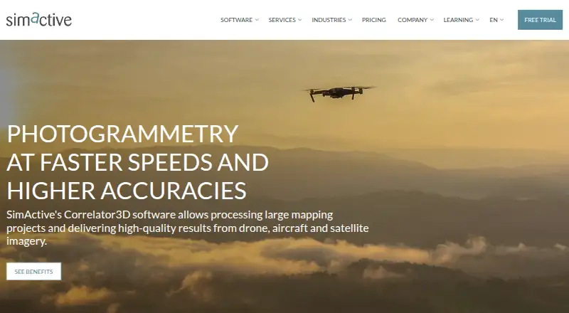
What Correlator3D is
Correlator3D is SimActive software for converting satellite, aerial, and drone imagery into geospatial outputs. It produces aerial triangulation, digital surface and terrain models, point clouds, orthomosaics, 3D models, Gaussian splat models, and vectorized 3D features. GPU technology and multi-core CPUs process large datasets, and projects have no stated image-count limit. Supported sensors include UAV, aerial, and satellite systems with infrared, multispectral, and hyperspectral imagery. Editing tools cover ground control points, tie points, DEMs, mosaics, 3D feature extraction, and splat models. LiDAR functions include imagery registration, point-cloud colorization, and orthorectification from LiDAR DEMs. The software is listed for self-hosted Windows use, with AWS and Microsoft Azure cloud solutions. A free PC trial license and expert processing are available.
Good
- Supports aerial, satellite, and drone imagery
- No image-count limit stated
- LiDAR registration and colorization tools
- GPU and multi-core processing
- Free trial license available
Watch out
- Windows PC requirements apply
- Plans up to 61 MP on listed subscriptions
- Some plan prices require contact
- Permanent licenses require substantial upfront payment
Who it suits
It suits geospatial, mapping, surveying, and imagery teams working with aerial, satellite, or drone data. Users need a Windows PC meeting the listed requirements or an applicable cloud setup.
Verdict
Correlator3D offers a wide geospatial output set and tools for imagery, LiDAR, and 3D editing. Its Windows requirements and paid plans should be weighed against the available free trial and unlimited-image support.
Plans and prices
From Correlator3D's own pricing page, checked 8 Oct 2026.
| Plan | Price | What it gives you |
|---|---|---|
| Monthly Subscription | $295 a month | Unlimited images · Up to 61 MP · All modules & tools · 295 USD/mo |
| Yearly Subscription | $2,950 a year | Unlimited images · Up to 61 MP · All modules & tools · 2,950 USD/yr |
| Permanent | $5,900, paid once | Unlimited images · Up to 61 MP · All modules & tools · 1 year technical support · 1 year software updates · 5,900 USD |
| Permanent Floating | $6,400, paid once | Unlimited images · Up to 61 MP · All modules & tools · 1 year technical support · 1 year software updates · Floating option · 6,400 USD |
| Large Format | Priced on request | Unlimited images · Unlimited image resolution · All modules & tools · 1 year technical support · 1 year software updates · Contact us |
| Satellite | Priced on request | Unlimited images · Unlimited image resolution · All modules & tools · 1 year technical support · 1 year software updates · Contact us |
| Medium Format | Priced on request | Unlimited images · Up to 100 MP · All modules & tools · 1 year technical support · 1 year software updates · Contact us |
The facts
Each one read from Correlator3D's own pages, with the date it was checked.
What it does
- Cloud options
- The system requirements page lists AWS and Microsoft Azure under cloud solutions.checked 8 Oct 2026
- Editing and tools
- Tools include ground control point creation, tie point editing, DEM editing, mosaic editing, 3D feature extraction and splat model editing.checked 8 Oct 2026
- Google integration and privacy
- Correlator3D can use Google account authentication to send user-initiated Gmail messages, and SimActive says it does not access Gmail inbox contents or Google Drive files.checked 8 Oct 2026
- Image limit
- SimActive says Correlator3D has no limit to the number of images per project.checked 8 Oct 2026
- LiDAR
- The listed LiDAR capabilities include automatic imagery registration with LiDAR, point cloud colorization and orthorectification from LiDAR DEMs.checked 8 Oct 2026
- Microsoft integration
- When configured by the user, Correlator3D can authenticate with a Microsoft account and send user-initiated email notifications through Microsoft services.checked 8 Oct 2026
- Outputs
- It produces aerial triangulation, DSMs, DTMs, point clouds, orthomosaics, 3D models, Gaussian splat models and vectorized 3D features.checked 8 Oct 2026
- Processing
- The software uses GPU technology and multi-core CPUs to process large datasets.checked 8 Oct 2026
- Purpose
- Correlator3D generates geospatial data from satellite and aerial imagery, including drone imagery.checked 8 Oct 2026
- Security
- SimActive says it takes reasonable technical and organizational measures to protect user information from unauthorized access, disclosure or misuse.checked 8 Oct 2026
- Services
- SimActive offers expert image processing, customized training and workflow optimization services.checked 8 Oct 2026
- Support
- Users are assigned a technical advisor for tailored solutions, and software updates are delivered through the interface.checked 8 Oct 2026
- Supported imagery
- It supports UAV, aerial and satellite sensors, including infrared, multispectral and hyperspectral imagery.checked 8 Oct 2026
The company
- Founded
- 2003checked 28 Sep 2026
- Headquarters
- Montreal, Quebec, Canadachecked 28 Sep 2026
Where it runs
- Platform requirements
- The standard PC requirements list 64-bit Windows 7, 8, 10 or 11, 12 GB RAM and an NVIDIA or AMD graphics card.checked 8 Oct 2026
Money
- Trial
- SimActive offers a free Correlator3D license to try on a PC and also offers free processing by its experts.checked 8 Oct 2026
Alternatives to Correlator3D
- 1

WebODM
Free planOpen sourceWebAPILinuxmacOS8.3From $24 a month - 2
PIX4Dcatch
Free planAndroidiOSWindows7.4From $132.50 a month - 3
DroneDeploy Aerial
AndroidiOSWebAPI7.1From $1,908 a year - 4
Agisoft Metashape
WebLinuxmacOSWindows7.0 - 5
Propeller Platform
AndroidiOSWebAPI7.0 - 6

3DF Zephyr
Free planWindows6.8From €250 a month