
Atlas FieldOps
Atlas FieldOps is monitoring and evaluation software for projects, forms, field operations, submissions, maps, indicators, reporting, data quality, governanc…
What Atlas FieldOps is
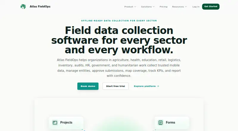
Atlas FieldOps is monitoring and evaluation software for projects, forms, field operations, submissions, maps, indicators, reporting, data quality, governance and administration. It brings together work assignments, submission review and approval, GIS mapping, KPI tracking and governed reporting. Its form builder has more than 40 field types, including GPS, geofences, photos, signatures and barcodes, with logic and validation. On Android, field teams can collect forms, location data, photos and consent offline, then sync queued work when connected again. The platform flags duplicate records, outliers, GPS issues, missing data and validation failures, with workflows for review, correction and audit. A versioned public API is available, and listed destinations include Power BI, Tableau, Looker, spreadsheets and internal analytics pipelines. Security controls include role permissions, immutable audit records, consent and retention controls, export governance, and backup and recovery architecture. Atlas describes a focus on offline-first deployment for African operating conditions, low bandwidth and distributed field teams. Pricing is on request; a free trial is available. Intended users include NGOs, governments, donors, research and program teams.
Good
- Offline Android collection with queued-work syncing.
- Form builder includes more than 40 field types.
- Flags missing data, duplicates and validation failures.
- Includes GIS mapping and indicator tracking.
- Offers review, correction and audit workflows.
Watch out
- Pricing is available on request.
- Starter has limited integrations and API access.
- The mobile collector is Android-based.
- No certification is named.
Who it suits
It suits organizations running field programs that need offline Android data collection, review workflows and reporting. The listed users include NGOs, governments, donors, research teams, and health, education, agriculture and humanitarian programs.
Verdict
Atlas FieldOps combines field data capture and quality controls with review, mapping and reporting. Teams should check plan differences for integrations and API access and confirm the pricing that applies to their needs.
Plans and prices
From Atlas FieldOps's own pricing page, checked 15 Oct 2026.
| Plan | Price | What it gives you |
|---|---|---|
| Enterprise | Priced on request | Everything in Professional · Advanced RBAC · Audit and governance · API access · SSO readiness · Dedicated success plan · Custom |
| Professional | Priced on request | Everything in Starter · GIS mapping · Indicator tracking · Data quality rules · Advanced exports · Implementation support · Contact sales |
| Starter | Priced on request | Projects and forms · Offline mobile collection · Submission review · Basic dashboards · Email support · Contact sales |
The facts
Each one read from Atlas FieldOps's own pages, with the date it was checked.
Where it runs
- Android app
- The mobile collector is an offline-first Android application with QR-based login, registered devices, sync queues, GPS, photos, consent capture, and remote logout.checked 15 Oct 2026
- GIS mapping
- GIS features visualize project boundaries, submission points, entities, facilities, coverage gaps, routes, and spatial quality issues.checked 15 Oct 2026
What it does
- API limits
- The plan comparison marks integrations and API as Limited on Starter, Available on Professional, and Custom on Enterprise.checked 15 Oct 2026
- Compliance
- Atlas FieldOps says it is designed for donor, government, safeguarding, and privacy-focused operating environments; the page does not name a certification.checked 7 Oct 2026
- Compliance statement
- The security page says the platform is designed for donor, government, safeguarding, and privacy-focused environments but names no formal certification.checked 15 Oct 2026
- Data import
- Spreadsheet uploads can be mapped to form columns, cleaned in an Excel-like grid, and confirmed for review or use.checked 15 Oct 2026
- Data quality
- Quality controls flag duplicates, outliers, missing data, invalid GPS, validation failures, profile conflicts, and unlinked records.checked 15 Oct 2026
- Documentation
- A public user guide covers setup, projects, forms, assignments, mobile synchronization, approvals, imports, entities, quality, mapping, indicators, reports, governance, and administration.checked 15 Oct 2026
- Entity records
- Entity categories can represent farmers, households, facilities, schools, stores, assets, products, cases, routes, or custom records linked to approved submissions.checked 15 Oct 2026
- Field operations
- Managers can assign forms, entities, locations, visits, and activities to field officers while supervisors monitor progress and approve movement requests.checked 15 Oct 2026
- Field workflows
- It supports work assignments, submission review and approval, GIS mapping, KPI tracking, and governed reporting in one platform.checked 7 Oct 2026
- Form builder
- The form builder supports surveys, inspections, audits, stock counts, registrations, delivery proof, training records, follow-ups, and custom workflows.checked 15 Oct 2026
- Form field types
- The form builder advertises more than 40 field types, including GPS, geofencing, photos, signatures, barcodes, ratings, matrices, and repeat groups.checked 15 Oct 2026
- Form logic
- Forms support skip logic, required fields, range checks, consent checks, reference data bindings, versioning, templates, and XLSForm import.checked 15 Oct 2026
- Indicator calculations
- Approved submissions can automatically calculate indicator results using sum, count, average, and percentage formulas tied to form questions.checked 15 Oct 2026
- Indicators
- Indicator frameworks support reusable indicators with definitions, units, baselines, targets, formulas, reporting frequency, owners, and disaggregation.checked 15 Oct 2026
- Integrations
- The integrations page names Power BI, Tableau, Looker, spreadsheets, GIS platforms, data warehouses, CRM systems, and internal analytics pipelines as destinations.checked 15 Oct 2026
- Intended users
- The help center names NGOs, governments, donors, research teams, health programs, education programs, agriculture teams, and humanitarian operations as users.checked 7 Oct 2026
- Limit: advanced governance
- Advanced RBAC, audit and governance, API access, SSO readiness, and a dedicated success plan are reserved for Enterprise.checked 15 Oct 2026
- Limit: pricing transparency
- All listed plans use contact-sales or custom pricing, with no numerical prices published on the pricing page.checked 15 Oct 2026
- Mobile access
- The mobile collector is an offline-first Android app with QR-based officer login, registered devices, and remote logout.checked 7 Oct 2026
- Offline collection
- Field officers can collect forms, GPS, media, and drafts offline and synchronize queued work when connectivity returns.checked 15 Oct 2026
The company
- Company focus
- The company describes its focus as offline-first technology for African deployment realities, low bandwidth, and distributed field teams.checked 15 Oct 2026
- Company mission
- Atlas FieldOps says its mission is to make field operations easier to run, verify, and explain.checked 15 Oct 2026
Alternatives to Atlas FieldOps
- 1

CommCare
Free planOpen sourceAndroidWebAPISelf-hosted8.3From $100 a month - 2

ActivityInfo
AndroidiOSWebAPI7.7From €545 a year - 3
Socialsuite
AndroidiOSWeb7.5 - 4
Clear Impact
Free planWebAPI7.3From $3,000 a year - 5

FRUIT Impact
Free planWeb7.3From $39 a month - 6
Impact Genome Registry
Free planWebAPI7.3$1,000 one-time